


CBC News: Severe storms are coming back to the Tri-State Area with a flood watch issued for New York City and parts of New Jersey.
The morning starts off wet for communities mainly inland. It’s humid with temperatures in the 60s to low 70s.
Things ramp up in the afternoon with isolated to scattered downpours. Flash flooding is likely in the evening as severe thunderstorms soak the area.
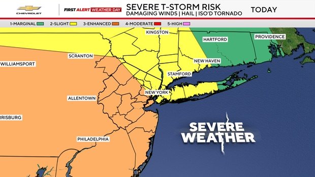
It’s a First Alert Weather Day due to the threat of strong-to-severe thunderstorms.
Is it going to rain today?
These storms may contain damaging winds, large hail and torrential downpours.
The New York City Emergency Management Department issued a weather alert and activated the city’s Flash Flood Emergency Plan.
“This proactive approach includes pre-storm actions such as targeted inspection and clearing of catch basins in flood-prone areas,” a news release stated.
Flood watches, warnings issued
A flood watch is in place from 8 a.m. Tuesday to 2 a.m. Wednesday for New York City and most of New Jersey.
Rain could fall at a rate of one to three inches per hour, totalling two to three inches or more by the time the storms pass.
A flood warning is in place for Sussex and Warren Counties in New Jersey until 1 p.m.
Weekend weather looking good
Once the wet weather passes, the rest of the week looks dry with lower humidity. Temperature-wise, highs will generally be in the lower 80s this week, which is below average for late July.
Clouds will gradually increase at night, but we stay dry. Lows will be in the 60s in the suburbs to around 70 in the city.
Stormy Weather Returns with Flood Watch for NYC, Parts of N.J.